Summary
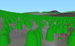
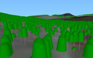
Actually seeing how landscapes may change helps the public to participate in land management
Summary
The VISULANDS project developed and applied visualisation tools to support public involvement in the assessment of landscape change. Forest Research coordinated three study sites that were used to test indicators, visualisations, and evaluate the perceptions and experiences of end users.
Our involvement
Forest Research helped to develop the methods for multi-dimensional analyses of landscape quality. The researchers applied their expertise on landscape ecology and stakeholder engagement. Forest Research also coordinated the development and testing of VISULAND prototypes at three case study sites: Clashindarroch (Northern Scotland), Isle of Wight (Southern England) and Clocaenog (North Wales).
The team assessed how visualisation methods could be used for forested landscapes in the UK, looking at whether visualisation tools could support stronger visual design and landscape ecology, and greater public participation in forest landscape planning.
Funders and partners
![]()
VISULANDS was a 3-year European Commission funded 5th Framework research project led by Prof. David Miller, Macaulay, Aberdeen with project partners in Sweden, Norway, France, Switzerland, Portugal and the UK.
Forest Research’s involvement was also funded through the Forestry Commission’s Ecosystems and Biodiversity programme.
Status
2003-2005
Contact
VISULANDS – Forest Research involvement
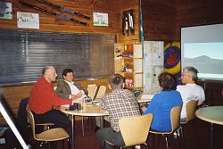 Forest Research was the UK project partner, supported by Forestry Commission Scotland’s (FCS) Landscape Adviser. Our involvement in the Visualisation tools for public participation in managing landscape change (VISULANDS) programme was:
- Participating in the development of methods for multi-dimensional analyses of landscape quality by applying expertise on landscape ecology and engagement with the end users, and providing case study sites
- Considering the applicability of the project/visualisation methods in British forested landscapes, and the potential to develop these into a new set of tools for forest landscape planning.
Much management is now focussed on decisions at scales greater than the stand or coupe. The advent of geographic information systems (GIS) as a management tool has transformed the ease of dealing with spatial data – but the development of models to support the new decisions has lagged behind.
Forest Enterprise have explored a number of visualisation techniques, with ‘Forester’ – and there appeared to be scope for incorporating landscape ecology principles within this. However, while the GIS technical fixes were soluble, there were substantial and fundamental questions about how to incorporate assessments of other landscape qualities into the land use and landscape decisions – and also the validity of the technical methods in enhancing the participation of many in the decision-making process.
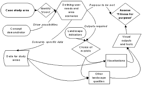
VISULANDS project workflow
Data collation for 3D models
We were responsible for collating data for the 3D models of the United Kingdom case study sites. Different forest management scenarios (such as expansion of woodland area, translocation of forests with agricultural land and changes to management practice of current forests) were identified and tested (involving ecological site classification and productivity models and calculation of landscape ecology metrics).
Developing landscape change indicators
We developed landscape change indicators applicable to forests, and mixed agricultural/woodland areas, that can be validated against the results of preference models. We also assessed the consequences of land use scenarios on production from woodlands and consider the relationships between landscape functions.
Assessment, exploitation and technology transfer
We managed assessment and exploitation of the project, and assisted other groups to develop technology transfer and exploitation plans. We also assessed the value of the products derived by the project for local stakeholders at UK case sites.
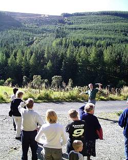
A particular study at Clashindarroch Forest in Buchan Forest District compared the effectiveness of these technological approaches with those relying less on technology but much on encouraging user involvement, such as the ‘Planning for Real’ process.
VISULANDS – Clashindarroch
 Visualisation tools for public participation in managing landscape change (VISULANDS)
This site in Northern Scotland, provides a diverse landscape of managed agriculture, moorland and forest land use within a varied topography. There is a Scottish Forestry Alliance funded restoration project (Darroch Wids) which is expanding the area of native woodlands at the margins of an extensive Forestry Commission Scotland (FCS) productive forest.
Forest Research produced spatial datasets to advise FCS on the initial restoration scheme, and close links are maintained with the Project Officer (Liz Shortall).
This is the key Forest Research study site, used to test all aspects of the project – including public participation.
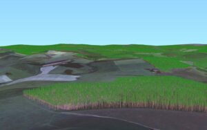
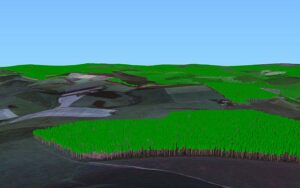
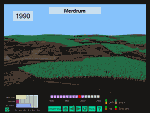
Time sequence visualisations of Merdrum and Clashindarroch Forest
Merdrum_kiosk.pps (MS PowerPoint®-2693 KB)
Note: The slide show is opened in a new window. Some versions of browsers prompt for each slide of the above to be opened individually. If this happens with your browser it is recommended that you download the file to your PC and run it directly from there.
Static visualisations of Merdrum and Clashindarroch Forest
What’s of interest
All visualisations have been created with Envision software.
VISULANDS – Clocaenog
Visualisation tools for public participation in managing landscape change (VISULANDS)
This site in North Wales is substantially wooded, and has important components of semi-natural heath that are valued for their appearance and fauna, as well as low value agricultural land. New methods of managing the forest to avoid clear-felling are being applied by Forestry Commission Wales (and studied by silvicultural groups within Forest Research). This could provide an opportunity to consider whether this does bring about expected benefits in visual experience (as well as providing habitat for important woodland species such as red squirrel).
The impacts of rapid land use change on biodiversity and related values are being studied by taking a historical perspective so that a full sequence of forest-related change can be analysed. This includes afforestation of grazing land, growth of productive forest, felling and replanting, retention of mature elements of the forest, development of continuous cover forestry. This work supplements initial site characterisation within the Forest Research Landscape Ecology project.
VISULANDS – Isle of Wight
Visualisation tools for public participation in managing landscape change (VISULANDS)
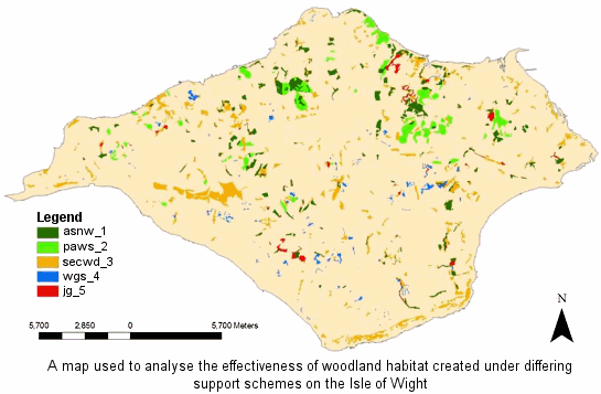 This site in South-east England, is dominated by agriculture with isolated blocks of forest. The landscapes of the island are highly valued and reflected in their status as Areas of Outstanding Natural Beauty (AONB). Recent grant-aided planting of trees has been encouraged by the desire to create forest habitat networks to benefit woodland biodiversity. Additional incentives have therefore been provided through the JIGSAW scheme for small woodland owners to coordinate their planting within the rural landscape to create networks.
The focus of the Forest Research work is in exploring the biodiversity valuation (indicator) approaches, including the application of the focal species approach and the BEETLE model. Indicators will be applied to scenarios with and without JIGSAW planting, to confirm its effectiveness and assist in future targeting. Links are being developed with the local Biodiversity Action Plan group – and there may be opportunities to explore end user views though partnership with the AONB staff. This will permit an assessment of the additional effects on landscape quality – and whether this strategic approach (for biodiversity benefit) meets the aims of the policymakers or the needs and preferences of the local community. It is hoped that this work could provide a basis for subsequent biodiversity monitoring.
General Content
What’s of interest
Time sequence visualisation for Clashindarroch Forest
Related pages
- Decision framework for public involvement in forest design planning
- People, trees and woodlands
- Society and diversity in relation to trees, woods and forests

