Summary
Overview
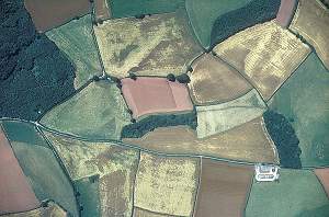
This research aims to incentivise woodland creation by strategically targeting land use changes to enhance biodiversity and achieve Biodiversity Net Gain. By developing an integrated woodland habitat network, the project identifies optimal areas for tree planting. These will improve connectivity and resilience of ecosystems, while safeguarding existing priority habitats.
Using advanced spatial data and mapping tools, this initiative aligns with the Local Nature Recovery Strategies (LNRS) and the Environmental Land Management Scheme (ELMS). Addressing habitat fragmentation, it supports species migration and climate change adaptation.
The project also prioritises transparent communication and stakeholder engagement, making findings and data freely available. This will help inform policy and land management decisions. It promotes sustainable woodland creation, fostering a more connected and resilient natural environment.
This project is part of the Nature for Climate Fund.
Research Objectives
- Develop a spatial opportunity map for woodland creation that maximises connectivity benefits for various woodland species without affecting existing open priority habitats and networks. This uses mapping from both Natural England and the Forestry Commission.
- Assess the benefits, impacts, and conflicts between the new and existing mapping layers.
- Communicate findings to users through an ArcGIS StoryMap.
- Demonstrate how the mapping can be used strategically to target locations that enhance woodland habitat resilience to climate change, improve connectivity, and facilitate species dispersal.
Latest Update
The discussions with Natural England and the Forestry Commission have been productive, and we have created a new, unified dataset. We are now at the stage of making final improvements in response to the positive and constructive feedback received from our partners: a testament to the collaborative effort of all involved.
We have also been applying the newly-created mapping tools to a practical case study. This is helping to plan woodland networks and where woodland creation may help to consolidate and expand woodland biodiversity. This co-development process enables shared understanding of the scientific and practical challenges and will help explore how spatial modelling can be applied to inform real-world issues.
Funding & Partners
- This project has been funded through the Government's ‘ Nature for Climate Fund’
-
 DEFRA
DEFRA -
Collaborating Partners
-
 Forestry Commission
 -
 Natural England